
Community
Dangerous heat and strong thunderstorms expected Thursday in Central Florida
By Katherine Langford
WFTV Orlando Local
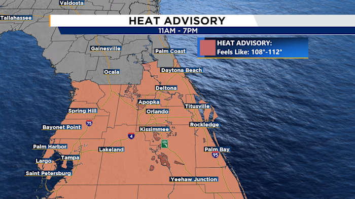
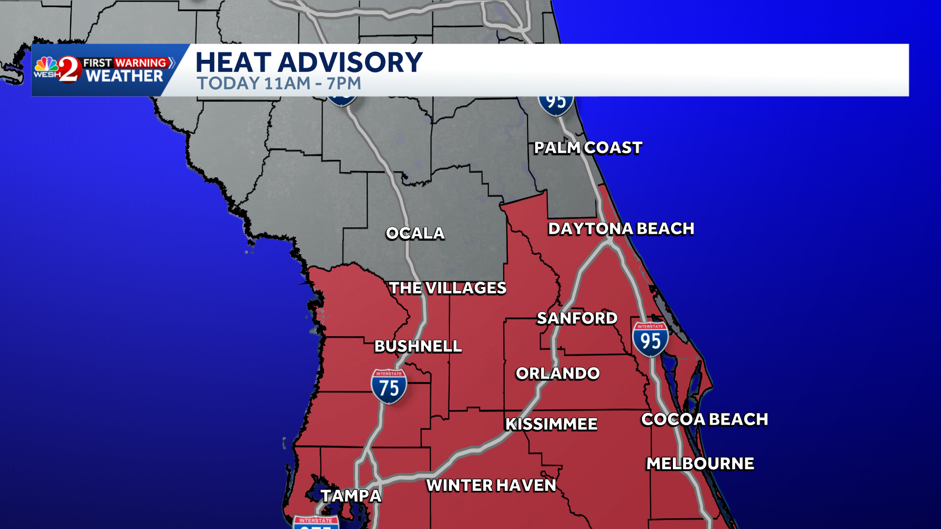
Central Florida is facing another day of dangerous heat and strong afternoon thunderstorms, a weather pattern that is expected to continue through Father’s Day weekend.THURSDAYA Heat Advisory is in effect from 11 a.m. to 7 p.m. as heat index values climb between 108 and 110 degrees across East Central Florida. While the actual air temperatures will reach the mid 90s, the combination of heat and humidity will make it feel much hotter.Storm chances will increase this afternoon as the east coast and west coast sea breezes collide across the peninsula. The highest coverage is expected from Brevard and Osceola counties northward, where rain chances range from 40 to 70 percent.Some storms could become strong, bringing frequent lightning, wind gusts up to 55 mph, and torrential downpours. Widespread rainfall totals of 2 to 4 inches are possible, with isolated locations seeing more than 5 inches where storms repeatedly track over the same area.A Marginal Risk for excessive rainfall is in place
Source: ClickOrlando Local
Ad Space Available
mid-article · 728px
By Katherine Langford
WFTV Orlando Local
By Marcus Chen
WESH 2 Orlando

By Marcus Chen
WFTV Trending Orlando

By Marcus Chen
WESH 2 Orlando